How to Hike Babia Góra – Route Guide from Przełęcz Krowiarki
Babia Góra (1725 m) is the highest mountain of the Western Beskids and one of the most rewarding summits in the region. This route starts at Przełęcz Krowiarki, climbs through forest to the open ridge, and follows it all the way to the summit before returning along the same trail.
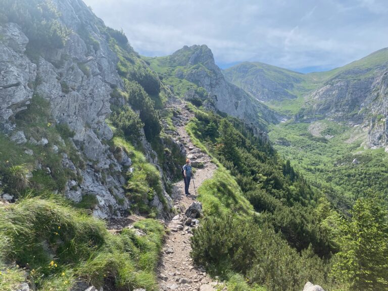
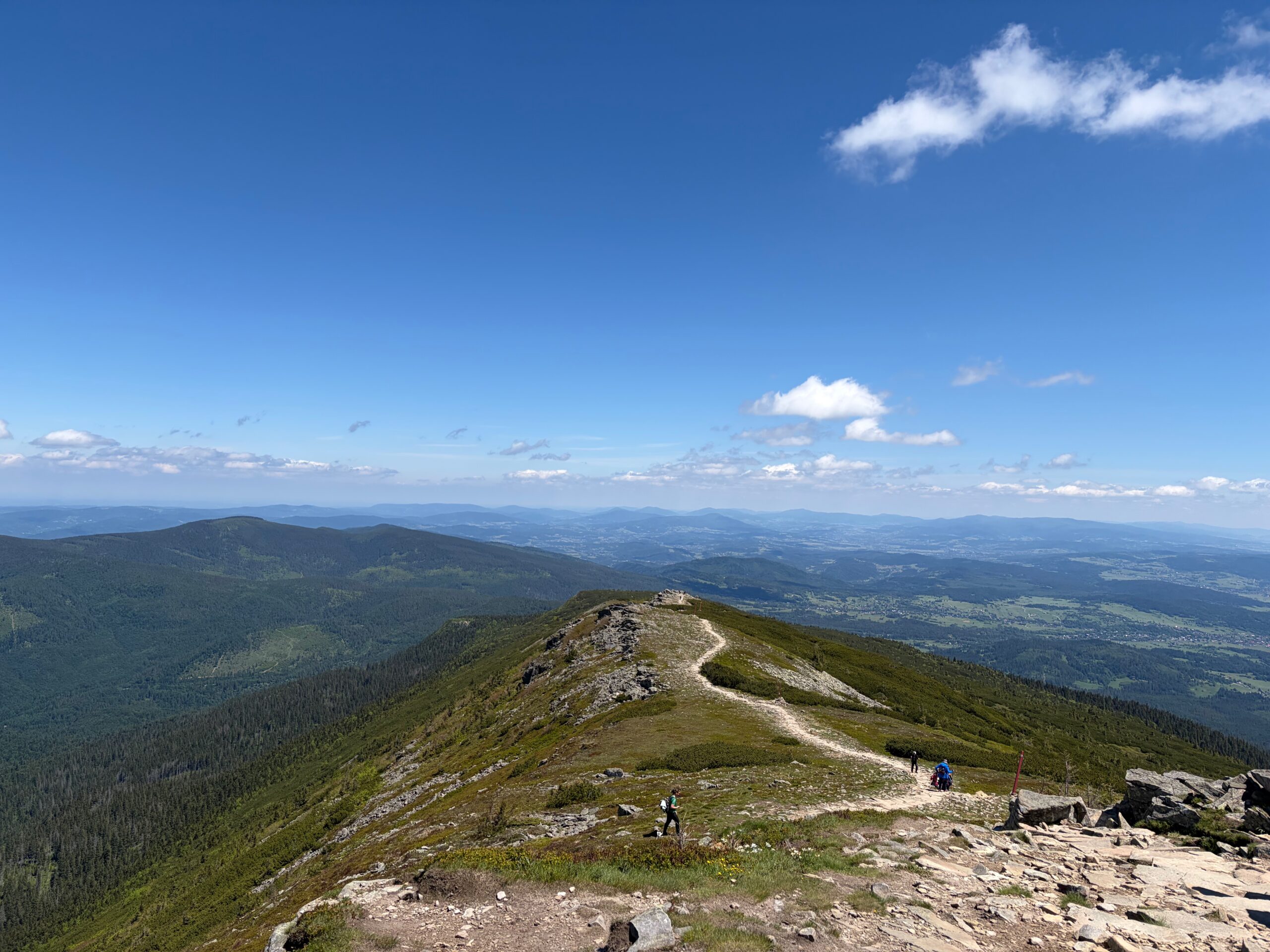
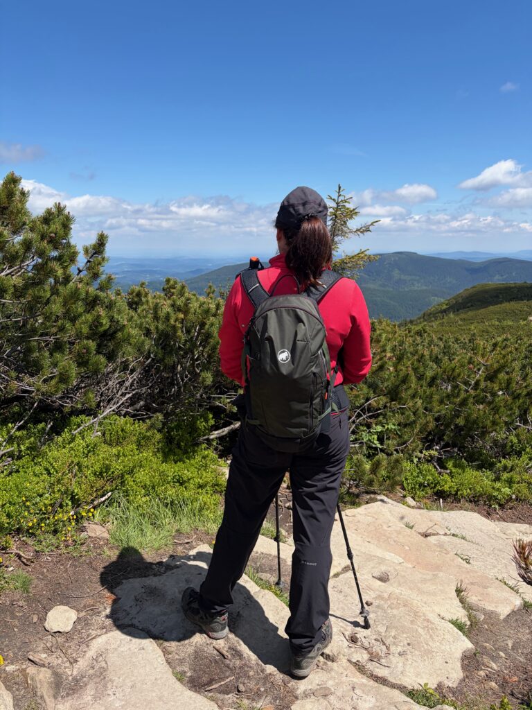
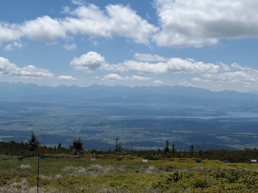
This was the most demanding hike of my time in the Beskids. It begins with a long, steep climb, but once that first section is behind you, a beautiful panorama opens up in every direction. The final stretch runs along an exposed ridge trail, with views of the valleys below and the Tatra Mountains in the distance.
The total route length is about 10.7 km and can typically be completed in around 4.5 hours.
Quick Facts
- Location: 49.587999, 19.582286 (Przełęcz Krowiarki)
- Distance: 10.7 km
- Elevation gain: 680 m up / 680 m down
- Time needed: ~4.5 hours
- Difficulty (1–5): 4
- Trail type: Mountain trail with steep sections, rocky terrain, and stone steps
- Parking: Paid parking (30 PLN/day). We visited just before the main season, so it’s hard to judge whether there’s enough space during peak times. Payments accepted by card, BLIK, and cash.
- Public transport: I can’t comment from experience — I saw a bus stop, but I don’t know about the available connections.
- Entrance fee: 10 PLN (bgpn.gov.pl/wstep-do-parku). We bought tickets on site at the kiosk, where you can pay with cash or card.
- Best season: June – October. We went in early June, just before the main season starts, while Polish schools were still in session, and it was excellent. The summer season is definitely much busier.
- Dog friendly: No (dogs are not allowed in most parts of the national park in Poland). However, you can reach this summit from the Slovak side, where dogs are allowed.
- Family friendly: Suitable only for families with older children who are comfortable with longer distances and steep, rocky terrain.
Parking & How to Get There
The trailhead is at Przełęcz Krowiarki. We parked in the first available car park, but we could see signs pointing to another car park further ahead.
Paid parking is available at the trailhead and costs 30 PLN per day. Payments are accepted by card, BLIK, and cash.
GPS: 49.587999, 19.582286 (Przełęcz Krowiarki)
Hiking the Trail
The trails here are very well marked and easy to follow — you don’t need any extra navigation devices, you just need to know which colour-marked trail you want to take.
The route described here is the red trail from Przełęcz Krowiarki, passing through Sokolica and up to the Babia Góra summit.
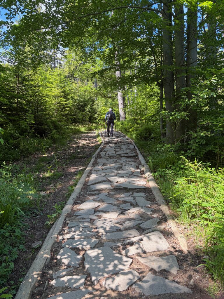
The trail starts on a steep forest path with a demanding climb. Because it runs through the forest, there’s shade even in summer, which can make the ascent easier on a hot day. While you’re under the trees, views of the valleys only appear through small gaps in the canopy, but the neighbouring valleys and more distant peaks soon come into view.
For the return, we chose the same trail, and walking back there are beautiful views in every direction. We really liked this choice, but there are other options too.
Highlights
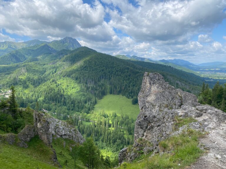
Sokolica (~1367 m): The first intermediate peak on the trail and an excellent viewpoint. Sokolica sits on the north-eastern ridge of the Babia Góra massif, along the red trail from Przełęcz Krowiarki. It’s a great spot with benches — from here you can see the entire Babia Góra massif.
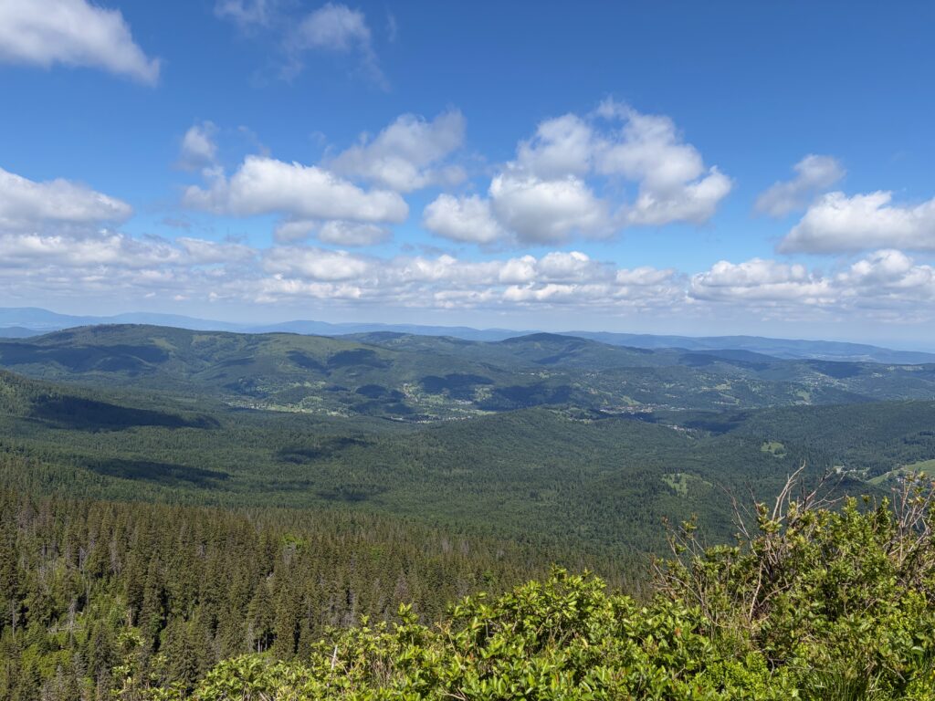
Kępa (~1521 m): The second intermediate peak, located between Sokolica and Gówniak. Kępa is another excellent viewpoint — from here you can see the Beskid Wyspowy, Gorce, Podhale, and the Tatras. On a clear day, the Tatras are visible to the south.
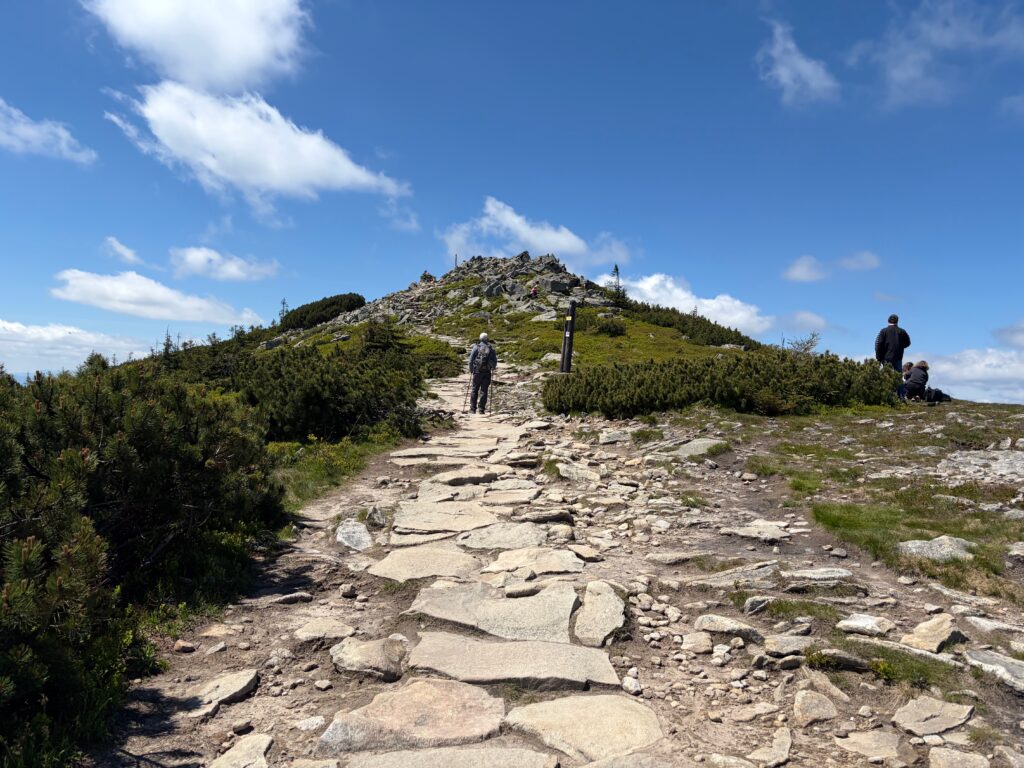
Gówniak / Wołowe Skałki (~1617–1644 m): This rocky peak is one of the so-called five ridge summits of Babia Góra, and hikers often mistake it for the actual Babia Góra summit — especially in fog, when the real summit isn’t visible. The peak is surrounded by a field of boulders (rumowisko).
Mały Garb Niżni (~1660 m) and Mały Garb Wyżni (~1675–1680 m): Small flattenings of the ridge above Gówniak. These aren’t distinct peaks, but rather steps in the terrain on the way to the summit. After this section, the trail leads to the summit itself through the boulder field.
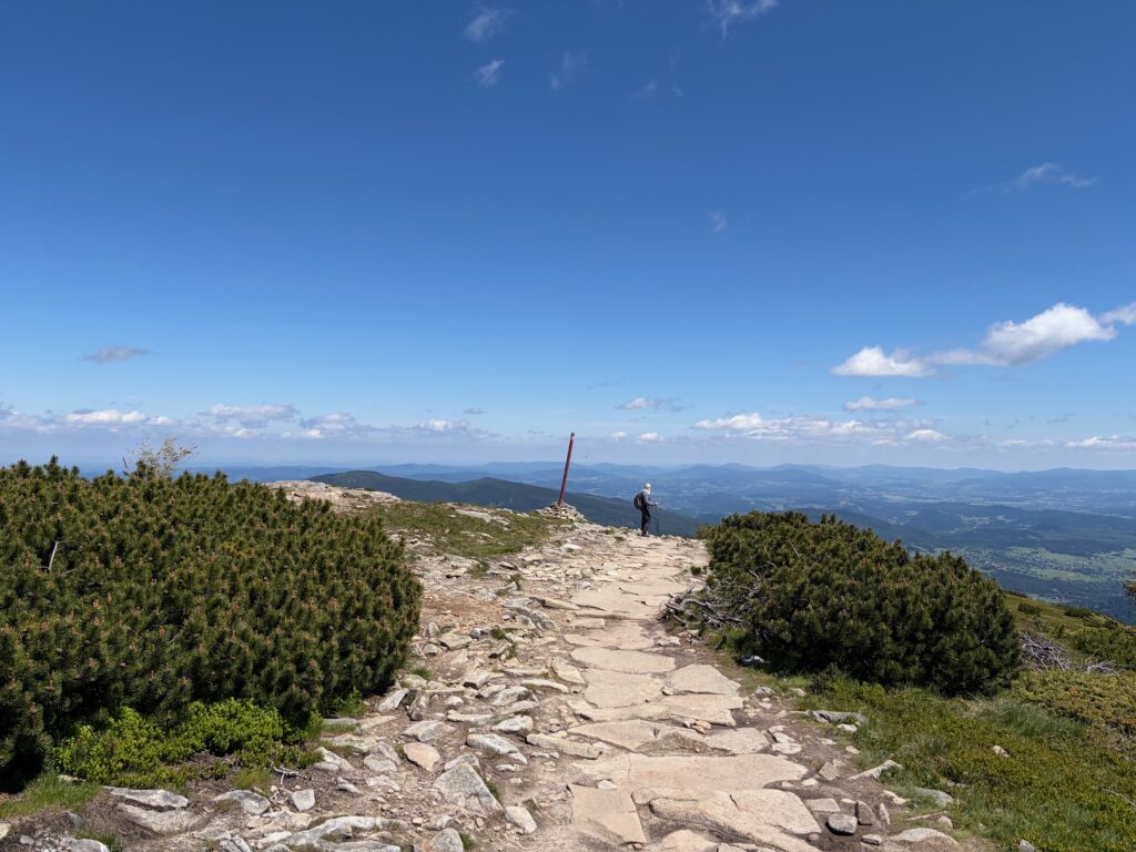
Babia Góra (Slovak: Babia hora, 1725 m): The highest point of the massif and the endpoint of the trail. It is the highest peak of the Babia Góra ridge and, at the same time, the highest “non-Tatra” peak in all of Poland. The summit area is surrounded by a field of boulders known as the Babia Góra rumowisko. The summit can be recognised by several landmarks. The most characteristic is a stone wall that serves as shelter from the wind. On the summit dome there is also an obelisk commemorating Archduke Joseph Habsburg’s ascent, a plaque dedicated to John Paul II, and a stone altar.
The Route Sections
Full video about trail: here
To Sokolica (~1367 m): The trail starts on a steep forest path with a demanding climb. As it runs through the forest, there’s shade even in summer, which can help on a hot day. Views of the valleys appear only through small gaps in the trees at first, but the neighbouring valleys and more distant peaks soon become visible.
To Kępa (~1521 m): The climb continues, but more and more opportunities open up to enjoy the beautiful scenery. The forest thins out and this section is relatively short.
To Gówniak / Wołowe Skałki (~1617–1644 m): There are fewer and fewer trees, the climb is no longer as steep, and it’s a real pleasure to walk this section, with views opening up on both sides — the Tatras are also visible in the distance.
To Babia Góra (1725 m): The final section is very beautiful. The trail continues along the ridge, leading over several small rises that make you think you’ve reached the destination — but the trail still goes on.
Return via the red trail: Head back along the same red trail. On the way back, it’s best to simply soak up the beautiful views.
When to Visit
- Avoid Crowds: July and August are the busiest months. For the best experience, visit in early June or September–October.
- Best Time: It’s beautiful in every season.
- Conditions: In wet weather the rocky sections become very slippery. The described route — the red trail from Przełęcz Krowiarki through Sokolica to Babia Góra — is open all year, but some other trails are closed in winter, so check the park’s website for current information.
What to Bring
- Water: Carry enough water for the full climb.
- Food: This is a long day out — bring enough food for the full hike.
- Footwear: Good hiking boots are essential. The rocky terrain, stone steps, and potentially wet conditions all require proper grip and ankle support.
- Layers: Babia Góra is famous for its highly changeable weather — it’s nicknamed the “Mother of Bad Weather” and the “Capricious One.” Even if it’s calm down in the valleys, the summit can have strong wind, fog, or storms. The wind is strongest in the summit zone above the dwarf pine belt.
- Trekking poles: I used trekking poles on this hike and they were a big help in many situations — they take a lot of strain off your knees on the steep climb and the long descent, and give you extra stability on the rocky sections.
- Protection: Sunscreen is important on the exposed upper sections of the trail.
- Early start: Aim to begin hiking by 7–8 am at the latest. This helps you avoid the worst of the crowds.
- Person ID: Since the Polish–Slovak border runs along the ridge, don’t forget to bring an ID document.
Is This Hike Worth It?
Absolutely.
Despite the steep climb at the start of the trail — and the corresponding descent at the end — this is a very beautiful hike. Once you’ve made it through the first part, the rest is a pleasure, with views in every direction.
Many trails lead up to and down from the summit, which lets you extend the hike or vary your route.