Beskids hidden gem: Szczyrk Loop to Malinowska Skała
This time we head to one of Poland’s hidden gems – Szczyrk, located not far from Zakopane. The mountains here are lower, but in return it’s far quieter, with fewer tourists and the chance to enjoy nature and wonderful views in peace.
The Szczyrk Loop is a way to enjoy an easy walk through the mountains, combined with cable cars and chairlifts. The route described here uses all the available lifts, but there are many options for variation — both with longer walks and with less reliance on the lifts.
The walk from Małe Skrzyczne to Malinowska Skała and back is 6.5 km.
The walk from Małe Skrzyczne to Skrzyczeńska 1,2 km.
Quick Facts
- Start point: 49.696295, 18.991082 (SMR: A1 Szczyrk Gondola – Hala Skrzyczeńska)
- End point: 49.708095, 19.012646 (Skrzyczne COS lower station, ul. Myśliwska 45, Szczyrk (B3 lift bottom station)
- Distance: 7.6 km on foot, plus a route using four lifts
- Elevation gain: 180 m up / 140 m down
- Time needed: ~3 hours — a walk, four lift rides, and lunch at a mountain lodge
- Difficulty (1–5): 2
- Trail type: Mountain paths with gentle elevation gain; large puddles in wet weather.
- Parking: Available.
- Public transport: Yes.
- Entrance fee: Free
- Best season: June – October. We went in early June, just before the main season starts, while Polish schools were still in session, and it was excellent. The summer season is definitely much busier.
- Dog friendly: Yes
- Family friendly: Suitable for families with children, as you can choose to walk just the short route between the two lifts, or the longer one, which also has only very gentle elevation gain.
Parking & How to Get There
There is a car park at the lift station.
The route 120 bus runs along the town’s main street (timetable), which is convenient to use, since the start and end points are different. We chose to stay in Szczyrk and got around using only public transport, which also lets you plan your routes freely during the day according to your wishes and the weather.
GPS: 49.696295, 18.991082 (SMR: A1 Szczyrk Gondola – Hala Skrzyczeńska)
The Lifts
This loop uses all four lifts of the Pętla Szczyrkowska (Szczyrk Loop) — a single ticket covers one ride (up and down) on all four lifts across two resorts, Szczyrk Mountain Resort and Skrzyczne COS. You can ride them in any order and direction, which makes it easy to build a route to suit you.
We used them in this order:
- A1 – Szczyrk Gondola → Hala Skrzyczeńska. A 10-person gondola from Szczyrk Salmopol up to about 1000 m. Dogs are allowed on board, and the cabins are accessible for wheelchair users.
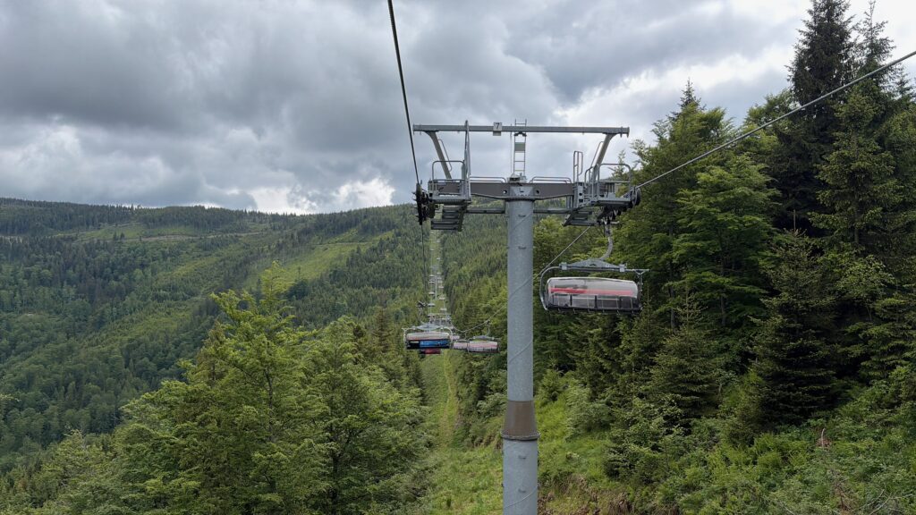
- B5 – Hala Skrzyczeńska → Zbójnicka Kopa. A 6-person chairlift up a scenic line to Zbójnicka Kopa (1205 m), where the ridge walk begins. Open to hikers in summer only — in winter it’s for skiers and snowboarders.
- B4 – Skrzyczne → Jaworzyna. A 4-person chairlift taking you off the summit of Skrzyczne (1257 m) and partway down the mountain.
- B3 – Jaworzyna → Skrzyczne COS lower station (ul. Myśliwska 45). The final chairlift down to the valley, where you can catch the bus back into Szczyrk.
A few practical notes: the lifts are also open to cyclists using the Szczyrk Enduro Trails, so watch for bikes where trails cross. Operating hours change between summer and winter, so check before you set off — and note that the B5 chairlift to Zbójnicka Kopa is only available to hikers in summer.
🎫 Tickets and current prices for the Szczyrk Loop here. Tickets are cheaper when purchased on their website.
Hiking the Trail
This route is suited to anyone who wants to enjoy mountain scenery but can’t or doesn’t want to take on big climbs. It’s an ideal place to find something to match your level:
The shortest route runs from one lift to the other. It’s only about 1,2 km long and is manageable even for small children.
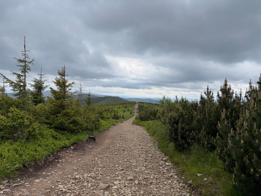
The longest route goes there and back to Malinowska Skała, and is 6.5 km. The route mostly follows a wide mountain track, and only the final part is rockier, with a short climb. In wet weather the path can have large puddles.
The longer route can be extended further to the summit of Malinów (1115 m), about 2 km one way, or even to Biały Krzyż (the White Cross), which is 5 km one way.
Highlights
The lifts up to the ridge (A1 + B5): The ascent is done in two stages. First the 10-person A1 gondola from Szczyrk Salmopol carries you up to Hala Skrzyczeńska at around 1000 m — and you can bring your dog along. From there you change onto the 6-person B5 chairlift, which runs year-round up a very scenic line to Zbójnicka Kopa at 1205 m, with views over Szczyrk and the surrounding peaks led by Skrzyczne and Klimczok. This lifts you straight onto the ridge and skips all the steep climbing. (Note: in summer the B5 chairlift is open to hikers, but in winter it’s for skiers and snowboarders only.)
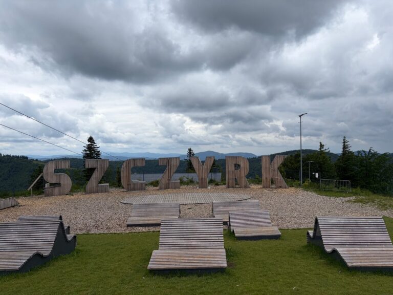
Małe Skrzyczne (~1210 m): A broad, open summit on the main ridge, shaped by ski infrastructure. At the top you’ll find benches, information boards, and the start of a downhill bike track. Because the slopes have been cleared, the trade-off for the developed feel is wide, open views in every direction. This is where the easy ridge “highway” toward Malinowska Skała begins.
Kopa Skrzyczeńska (~1190 m): A gentle rise on the ridge between Małe Skrzyczne and Malinowska Skała. The walking is easy, with only small, gentle height differences.
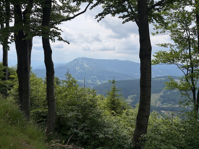
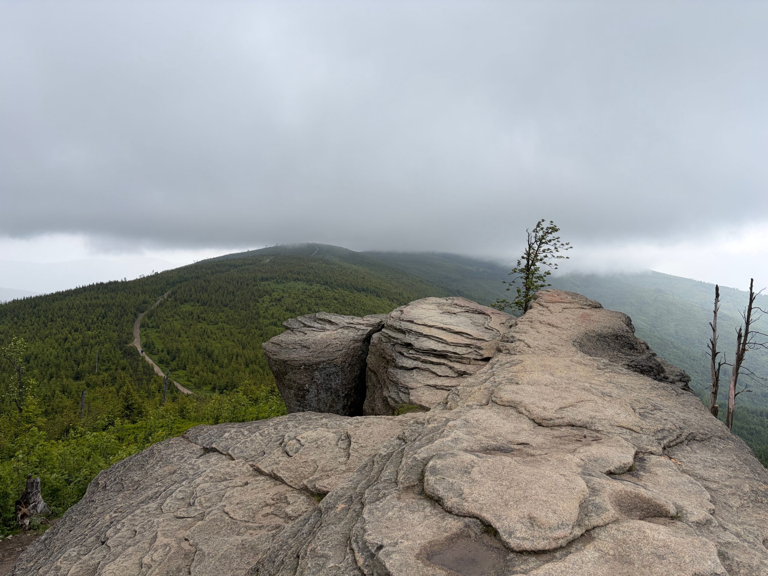
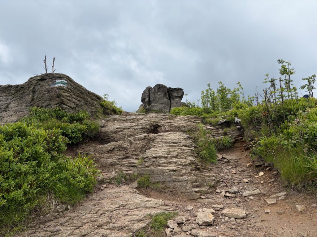
Malinowska Skała (~1152 m): The scenic highlight and a famous symbol of the Silesian Beskids — a massive lone rock that rises from the ground like a solitary mushroom. There are several benches here to sit and admire the panorama, and the summit of Skrzyczne with its characteristic mast is already in view. In good weather there’s a beautiful view toward Pilsko and Babia Góra. A short, steep, rocky climb leads up to the rock right at the end.
Skrzyczne (1257 m): The highest peak of the Silesian Beskids and part of the Crown of Polish Mountains. From the summit there are sweeping views over the whole panorama of the Beskids, and in good weather you can even spot the Tatras. There’s a PTTK mountain shelter just below the top, a viewing platform, and the characteristic tall mast that you can see from all along the ridge. This is where you pick up the lifts down (B4 then B3).
The descent lifts (B4 + B3): Rather than walking down, the loop finishes with two more chairlifts from Skrzyczne. The B4 chairlift runs from Skrzyczne down to Jaworzyna, and the B3 chairlift continues from Jaworzyna to the lower station of Skrzyczne COS on ul. Myśliwska. An easy, scenic way to end the day and save your knees.
The Route Sections
Full video about trail: here
Up by lift to the ridge (A1 → B5): Ride the A1 gondola from Szczyrk up to Hala Skrzyczeńska, then change onto the B5 chairlift up to Zbójnicka Kopa (~1205 m). The two lifts do all the hard climbing and deliver you straight onto the open ridge.
Zbójnicka Kopa to Malinowska Skała: From the top of the B5 chairlift, follow the wide, comfortable ridge track. You walk gently up and down — never flat, but with small, gentle height differences, mostly downhill — over Kopa Skrzyczeńska, with views opening on both sides. A short, steep, rocky climb leads up to Malinowska Skała at the end. This is the scenic highlight, with views toward Pilsko and Babia Góra in good weather.
Back along the ridge to Skrzyczne: Retrace your steps along the ridge, now heading toward the Skrzyczne mast. The walk back is comfortable and accessible, this time a little more uphill, taking around 1.5 hours. You pass back over Kopa Skrzyczeńska and continue up to the summit of Skrzyczne (1257 m).
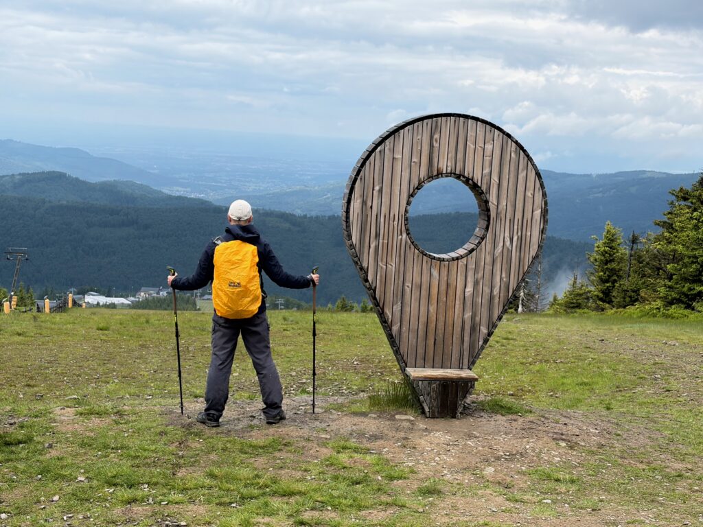
Descent by lift (B4 → B3): From Skrzyczne, take the B4 chairlift down to Jaworzyna, then change onto the B3 chairlift down to the Skrzyczne COS lower station on ul. Myśliwska. From there it’s an easy walk or a short bus ride back into Szczyrk.
When to Visit
- Avoid Crowds: July and August are the busiest months. For the best experience, visit in early June or September–October.
- Best Time: It’s beautiful in every season.
- Conditions: The ridge track is wide and easy, but it’s mostly open and exposed, so there’s little shade — bring sun protection in summer. In wet weather the path collects large puddles and the rocky climb up to Malinowska Skała becomes slippery, so good footwear helps. As always in the Beskids, the weather can change quickly, so check the forecast and the lift operating hours before you set off.
What to Bring
- Water: Bring enough water — the ridge is exposed and there’s little shade.
- Food: A few snacks are enough for the short loop; bring more if you extend the route toward Malinów or Biały Krzyż.
- Footwear: Good walking shoes are recommended. The track is easy, but the final climb to Malinowska Skała is rocky and can be slippery when wet, and the path collects puddles after rain.
- Sun protection: The ridge is open and sunny, so sunscreen and a hat are important in summer.
- Layers: Even on an easy day, the ridge can be windy and cooler than in town, so bring a wind- or rain-layer.
- Trekking poles: I used trekking poles and they were a big help in several situations — they take the strain off your knees on the descents and give extra stability on the rocky section near Malinowska Skała.
- Cash/card for the lifts: You’ll need a ticket for the gondola and chairlifts, so check current prices and opening hours in advance.
Is This Hike Worth It?
Absolutely — especially if you want big mountain views without a big climb.
By letting the lifts do the hard work, you get to enjoy the best part of the ridge: wide, open panoramas stretching toward Skrzyczne, the Silesian Beskids, and, on a clear day, Pilsko and Babia Góra in the distance. The walking is easy and flexible — you can keep it short enough for small children between the two lifts, or extend it all the way to Malinów or Biały Krzyż if you want more.
It’s a perfect choice for a relaxed day in the mountains, a quieter alternative to the crowds of Zakopane, and a great option for families or anyone easing into mountain hiking.
Related Trails
This is one of several hikes from our visit to the Beskid Mountains. If you’re after something more challenging, take a look at our guide to Babia Góra — the highest peak of the Western Beskids:
👉 How to Hike Babia Góra – Route Guide from Przełęcz Krowiarki